
Maps and Data
Maps and Data brings together the Great Green Wall's key geospatial tools, offering reliable satellite insights and interactive datasets for restoration planning.
Great Green Wall Geoportal
– powered by Earth Map
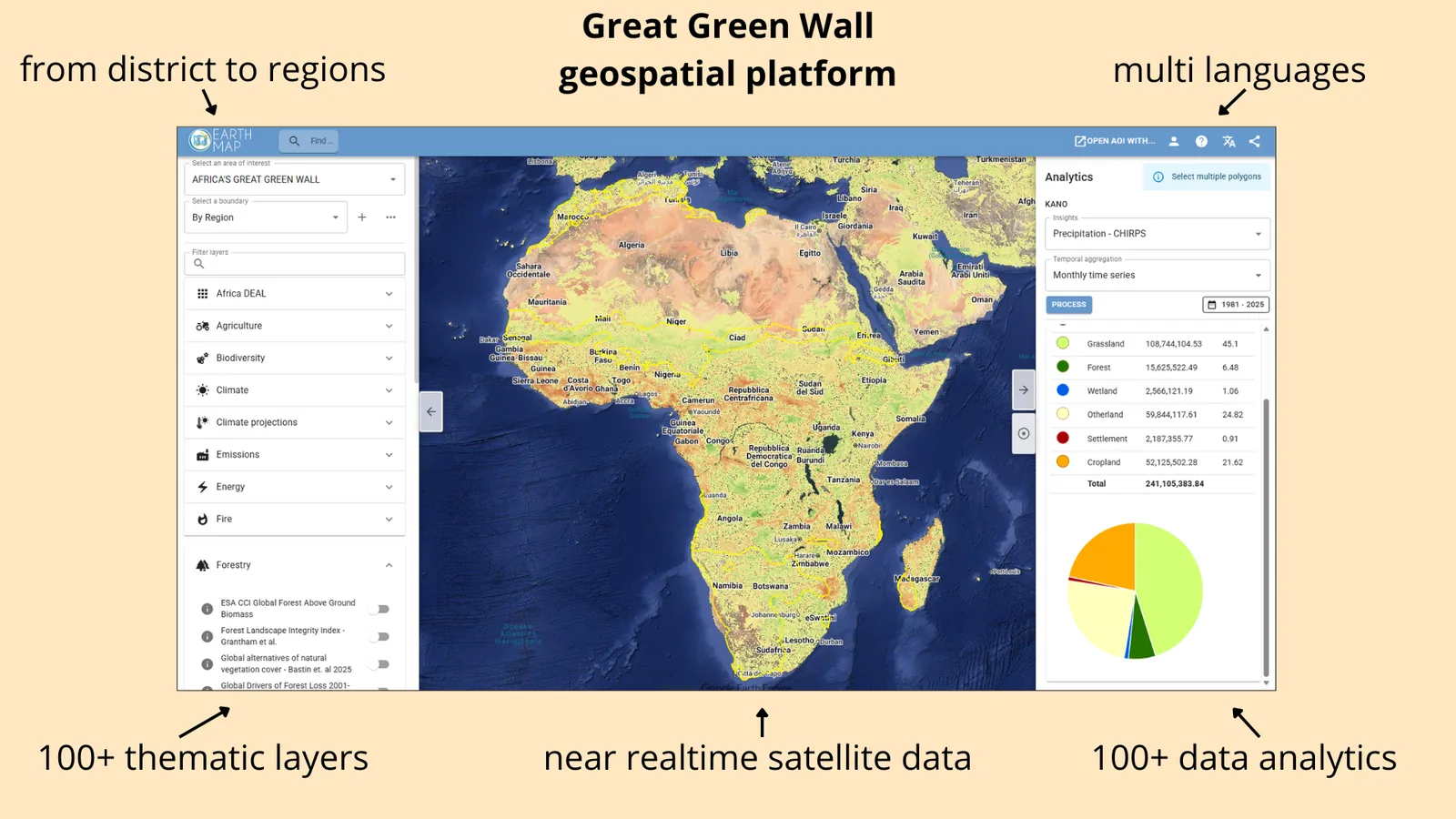
The Great Green Wall Geoportal is an advanced, user-friendly geospatial platform designed to support countries across the Sahel in monitoring, planning, and evaluating landscape restoration efforts. Built on EarthMap.org technology, the platform provides seamless access to cutting-edge satellite data, environmental analytics, and over a hundred thematic information layers relevant to land restoration, climate resilience, and sustainable development.
With coverage spanning district to regional scales, the geoportal allows users to explore and analyze landscapes with unprecedented detail. Integrated near-real-time Earth observation data enables rapid assessment of vegetation trends, climate variables, land use changes, and environmental pressures across the Great Green Wall region.
The platform includes:
100+ thematic layers covering agriculture, forestry, biodiversity, climate, emissions, fires, and more.
Near real-time satellite imagery from multiple global data sources.
100+ analytical tools that generate charts, time-series, statistics, and restoration indicators for any selected area of interest.
Flexible boundary selection , allowing users to analyze countries, regions, districts, or custom polygons.
Multilingual interface , ensuring accessibility for all Great Green Wall countries.
Open, transparent, and ready-to-use workflows aligned with best practices in environmental monitoring.
Designed for government agencies, technical partners, researchers, and local implementers, the Great Green Wall Geoportal serves as a central, open-access hub for evidence-based decision-making. It empowers stakeholders with the data and tools necessary to track progress, target interventions, and accelerate land restoration across Africa's most ambitious environmental initiative.
Great Green Wall Restoration Monitoring App
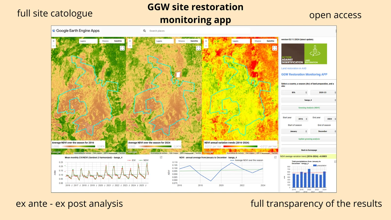
The Great Green Wall (GGW) Site Restoration Monitoring App is an open-access, science-based platform designed to track, evaluate, and communicate the progress of land restoration interventions across the Sahel. Built on Google Earth Engine technology, the app provides fast, transparent, and consistent monitoring of vegetation recovery at every restoration site supported under the Great Green Wall initiative.
The platform hosts a full catalogue of restoration sites, enabling users to quickly select a country, site, restoration year, and season to generate detailed greening analyses. Using harmonized Sentinel-2 and other satellite datasets, the app automatically computes vegetation indices (NDVI, EVI) and produces both seasonal and multi-year metrics to capture the evolution of restored landscapes.
Key features include:
Complete site catalogue covering all restoration areas under the Action Against Desertification programme.
Ex ante and ex post analysis, enabling comparison of landscape conditions before and after restoration efforts.
High-resolution NDVI/EVI metrics from harmonized Sentinel-2 data, visualized through maps, time-series graphs, seasonal profiles, and long-term trends.
Full transparency of results , with all data, methods, and visual outputs openly accessible and reproducible.
Automated, rapid processing thanks to the computational power of Google Earth Engine.
Open-access interface , allowing governments, technical partners, researchers, and communities to verify restoration outcomes in a simple and reliable way.
By combining robust satellite analytics with a user-friendly interface, the GGW Site Restoration Monitoring App ensures accountability, supports evidence-based land management, and strengthens countries' capacity to assess the impact of restoration investments across the Great Green Wall.
Restoration Sites
A comprehensive map of all Great Green Wall restoration actions
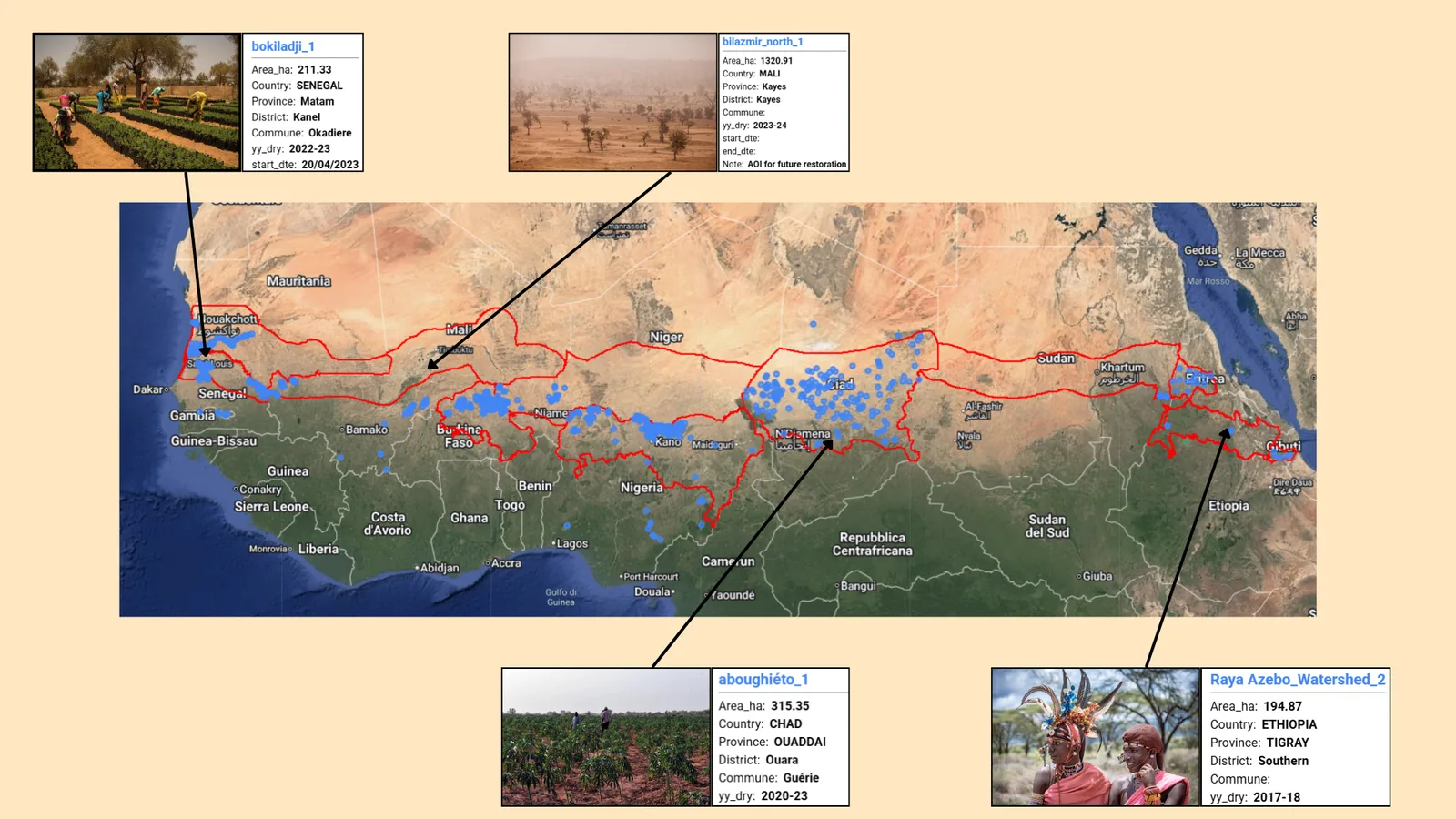
The Restoration Sites Atlas offers an interactive view of all Great Green Wall interventions, with detailed information for each site. Users can discover the restoration actions carried out, the local communities involved, and the various actors and partners engaged on the ground. The Atlas brings together the human, technical, and geographic dimensions of restoration efforts, providing a clear and accessible window into the work being done across the region.
Explore Restoration Sites
Visualize all GGW sites through an interactive map.
Access Site Information
Consult detailed sheets describing actions, context, and restoration types.
Identify Community Involvement
Discover the local communities involved and benefiting from each intervention.
Discover Implementation Actors
Consult the institutions, partners, and organizations responsible for the work.
Compare Interventions
Analyze differences in restoration approaches between countries and regions.
Support Planning and Coordination
Use spatial information to guide future interventions and strengthen collaboration.